3-D Highway in the Sky
Originating Technology/NASA Contribution
If it were 50 years ago, NASA’s contribution to rock and roll could have been more than just the all-astronaut rock band, Max Q, composed of six NASA astronauts, all of whom have flown aboard the Space Shuttle. If it were 50 years ago, a new NASA spinoff technology, Synthetic Vision, would likely have been able to prevent the fateful, small plane crash that killed rock and roll legends Buddy Holly, Ritchie Valens, and The Big Bopper on that stormy night in 1959. Synthetic Vision is a new cockpit display system that helps pilots fly through bad weather, and it has incredible life-saving potential.
In 1997, the White House Commission on Aviation Safety and Security created NASA’s Aviation Safety and Security Program (AvSSP) with the aim of sounding the depths of NASA’s cutting-edge aviation advances and history of successes. The AvSSP decided to use NASA technology to cut the rate of fatal aviation accidents that occur because of lowered visibility and spatial disorientation, common problems that arise in poor weather conditions, in the dark, or with inexperienced pilots.
Partnership
Aeronautics researchers at NASA’s Langley Research Center teamed with Chelton Flight Systems and the Federal Aviation Adminstration (FAA) Alaskan Region Capstone Program, a technology-focused safety program which seeks safety and efficiency gains in aviation by accelerating implementation of modern technology.
Because of the harsh Alaskan terrain, planes in this region are used for most common errands, whether it is a trip to the dentist or a grocery and supply run. Aviators in these unforgiving climates often fly low, around 200 feet above the ground, to avoid poor visibility and icing conditions in winter, and rely on lighted buoys anchored in lakes to guide their transit. It is the ideal area in which to test weatherproof guidance symbology. As part of the Synthetic Vision research and development testing conducted at Langley, a display concept replicating the Chelton display system was included in the test matrix and evaluated in simulation and flight-test experiments.
The result of the research is a 3-D display for pilots, which provides clear vision, regardless of the time of day or weather conditions. It also replaces the buoys with a series of onscreen markers that draw a virtual highway in the sky, on which the pilots can “drive.”
The simulated tests conducted by NASA, the FAA, and Chelton involved dozens of pilots in a variety of scenarios, with one specifically designed to cause an accident. The testing confirmed that with the Synthetic Vision system in place, fewer accidents occurred. In fact, Synthetic Vision lowered the chance of hazardous events 85 percent over traditional instrumentation. Because of these stellar results and continuing positive feedback from test pilots, Chelton’s Synthetic Vision system earned its name and its place as the first commercially available system of its kind ever offered. It is already being marketed and distributed by Chelton for use on small planes, light jets, and helicopters. The system is flying in hundreds of small planes all over the United States and abroad.
As a result of this successful and beneficial partnership, Langley, the FAA, and Chelton were presented with NASA’s “Turning Goals into Reality” award for aviation safety.
Product Outcome
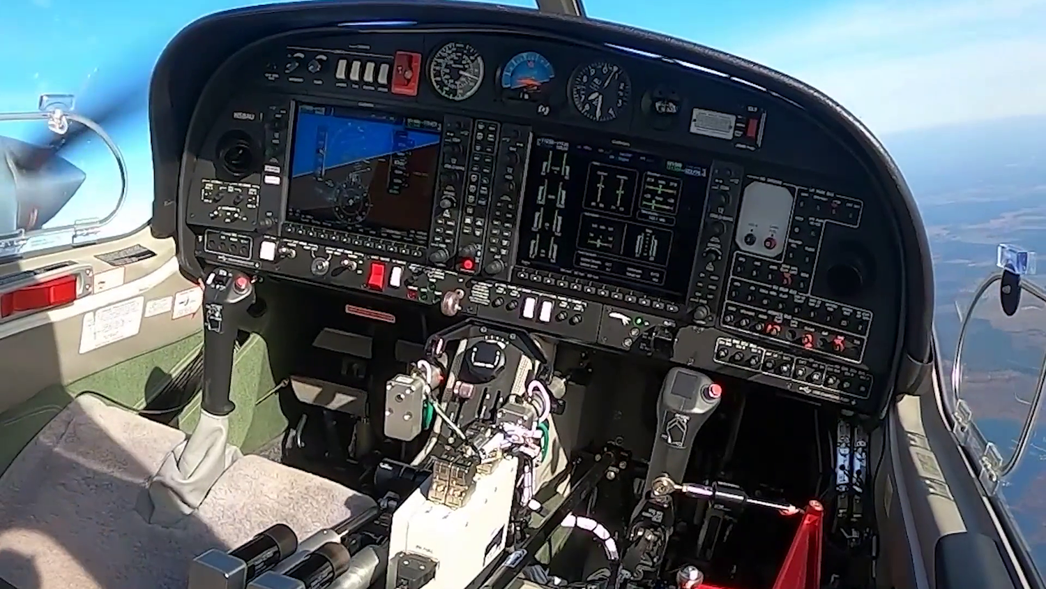
Synthetic Vision allows pilots to see their surroundings as if the sky were clear, regardless of the actual environmental conditions. It presents a real-time, forward-looking depiction of the terrain in 3-D, directly on the primary flight display. The pilot has a virtual view of his surroundings, in addition to the view afforded by the cockpit windshield. The system creates an artificial, computer-generated view of the surroundings from a series of databases and advanced sensory input, so it gives pilots topographical flight plans, as well as real-time feedback, about the area directly outside of the aircraft.
It is, at its core, a database-driven system, using onboard terrain, obstacle, and airport information databases and employs a highly precise navigational system to position the aircraft within those databases’ parameters. The system also contains a number of database integrity-monitoring technologies to help ensure that the presentation given to the flight crew is indeed a correct one. The pilot can program a flight plan into the Synthetic Vision system and the onboard computer will know which databases to access, and then provide the pilot with course markers that highlight the route the plane should take. These markers can even extend into the landing zone and create a trail that the pilot can follow straight through to landing.
In addition to the databases, Synthetic Vision may employ a series of advanced sensors that are sensitive enough to identify objects within close proximity of the aircraft. It extends the basic capabilities typically found on flight systems and, rather than just showing large topographical features like mountains, ridges, and valleys, it extends to man-made structures like buildings, towers, and other obstructions, such as vehicles on a runway.
The system is advanced to the degree that it can point out variations previously overlooked by traditional global positioning systems (GPS). For example, if a mountain ridge were to rise above the horizon, the Synthetic Vision system could alert the pilot; whereas, with typical GPS, the pilot would merely know that a mountain was near and the average altitude of the mountain. Synthetic Vision alerts the pilot with an audio signal to change the course of the airplane in order to avoid collision.
Not only does the Synthetic Vision system provide more information to the pilot, it is also easier to read. It flows naturally, as opposed to being broken into choppy video on the heavily-pixilated screens typical of most in-flight displays. The full-color, high-resolution screens mount in place of the cockpit flight displays and provide smooth, streaming video representations of what is happening in front of the plane.
Although successfully used in the Alaskan Capstone project and throughout the “lower-48,” it will still take time before the Synthetic Vision system is made available to commercial airlines. The Chelton EFIS Primary Flight Display has achieved Level A, the highest level of software standards established by the Radio Technical Commission for Aeronautics for the FAA. This standard is essential for all flight-critical avionics. The FAA is strict about approving new technologies for commercial airline use, and it is expected that this acceptance, though likely in the future, will occur after additional years of testing the technology. In addition, though Synthetic Vision has demonstrated its safety benefits, the airlines require an efficiency benefit before expending the capital to bring the technology aboard the aircraft. Subsequent Langley research is developing and evaluating these potential benefits.
EFIS Primary Flight Display™ is a trademark of Chelton Flight Systems.
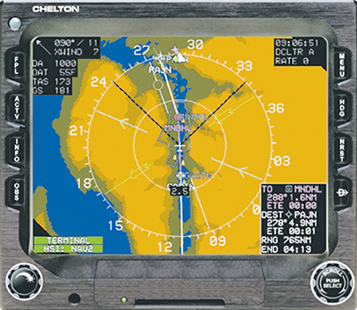
This top-down indicator of a flight approach to the Juneau International Airport in Alaska shows wind information, air temperature, true airspeed, and groundspeed, as well as the plane’s relationship to any towers, antennas, or obstructions, and additional information pilots use to fly safely in this arctic climate.

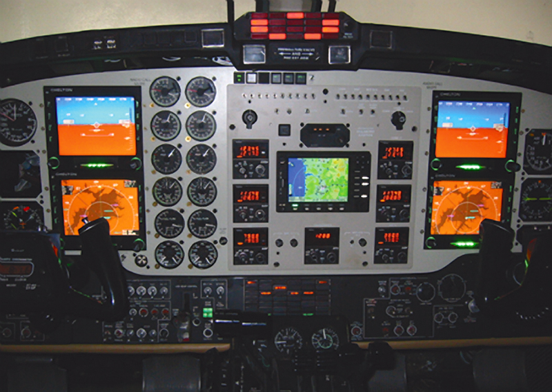
Synthetic Vision flight displays present real-time depictions of the terrain and complement the view the pilot has through the cockpit windshield. Here it has been installed in a Beechcraft King Air 300.


