
‘Digital Winglets’ for Real-Time Flight Paths
Subheadline
NASA-developed routing technology leads to fuel savings and smoother flights
Before airplanes even reach the runway, pilots must file a plan to inform air traffic controllers where they’re going and the path they are going to take. When planes are in the air, however, that plan often changes. From turbulence causing passenger discomfort and additional fuel use to unexpected weather patterns blocking the original path, pilots have to think on the fly and inform air traffic controllers of any modifications to their routes.
In the past, these changes would have to happen suddenly and without much lead time. But as airplanes have become more digitally connected, the flying machines can take advantage of the additional data they receive, and a NASA-developed technology can help pilots find the best path every time.
NASA has explored methods to improve aircraft efficiency since its inception. Among the agency’s most famous contributions are winglets, upturned vertical flanges at the ends of airplane wings that eliminate turbulence at the wingtip and lead to significant savings in fuel (Spinoff 2010). Fuel efficiency is incredibly important to future aircraft development, as not only does it improve the distance a plane can travel and the weight it can carry, but airplane engines release huge amounts of greenhouse gases into the atmosphere. Reducing aircraft fuel use means less carbon dioxide in the air.
David Wing, principal researcher of air traffic management at NASA’s Langley Research Center in Hampton, Virginia, develops advanced autonomy systems for aircraft, allowing operators to directly manage flight paths in crowded skies. He noticed that some of the same technology used for safe routing could also be used to optimize routes for flights already in the air. Allowing pilots to identify a better path as soon as it’s available could save time and money.
“Air traffic control is there to keep the aircraft safely separated from other aircraft,” said Wing. “So the trick is, when you need to change your routing, what route do you ask for, and how much is it going to save you?”
Under Wing’s lead, NASA developed Traffic-Aware Strategic Aircrew Requests (TASAR), a piece of software pilots and ground operations teams can use to find better routes in transit. TASAR works by using a genetic algorithm, a kind of machine learning system that finds the optimal answer by pitting hundreds of route changes against each other and seeing which one comes out on top. TASAR takes a map of the area and draws hundreds of lines radiating from the airplane. These lines represent potential routes the plane could take. The software whittles down every route it generates, avoiding ones that stray into no-fly zones or dangerous weather systems or get too close to other aircraft until it’s found the most efficient route the airplane can take. Then it’s up to the pilot whether to take the computer’s advice. Information is constantly being updated using sensors on the airplane and connections to ground-based services, which TASAR takes into account.
“The algorithms had been tested and matured already for many years in our autonomy research, so they were in pretty good shape,” Wing said. “But what we had to do was to connect this system to a real aircraft, which meant that we needed to be able to access data from the onboard avionics.”
On NASA test flights, the software worked perfectly, but for TASAR to break into more flights, commercial planes needed to be able to access large amounts of data. As it turned out, a solution was close at hand.
The company iJET originally built components that could keep planes connected to the latest information available on the ground, which often wasn’t available in the sky. After first developing better antennas, the company soon began working on a new integrated computer system for airplanes to take in data and stay connected to ground-based information sources. When looking for a “killer app” for the system, the company discovered TASAR.
“We saw that NASA was getting to the conclusion of this work, and we took a business decision to pick up the baton,” said Rob Green, CEO of the company.
After being acquired by another company called Aviation Partners, the Seattle-based company was renamed APiJET in 2018 and became the first company to license TASAR from NASA. APiJET proceeded to tie the software to the in-flight computer system. The company’s version of TASAR is called Digital Winglets, named after the NASA invention that has been saving fuel for decades.
The app runs on electronic flight bags, computer devices approved for use in flight operations by the Federal Aviation Administration, most commonly Apple iPads. Green said there are no plans to integrate it directly into a cockpit instrument panel, because an app can be updated more easily. In testing with Alaska Airlines, Green said the program saved 2% on fuel, working out to approximately 28,000 pounds of fuel per hundred flights.
“Two percent may not sound like much, but little savings can really add up at airline scale,” Green said.
Several more airlines have tested the technology since, and Frontier Airlines is field testing for a potential deployment of Digital Winglets across its fleet. APiJET still keeps in touch with the developers at NASA to further research TASAR’s benefits and build out its commercial capabilities.
“Everybody that worked on TASAR at NASA should be really proud of the direct impact they are having in fuel savings and carbon reduction,” Green said. “It’s a lot to get your head wrapped around, but it works.”
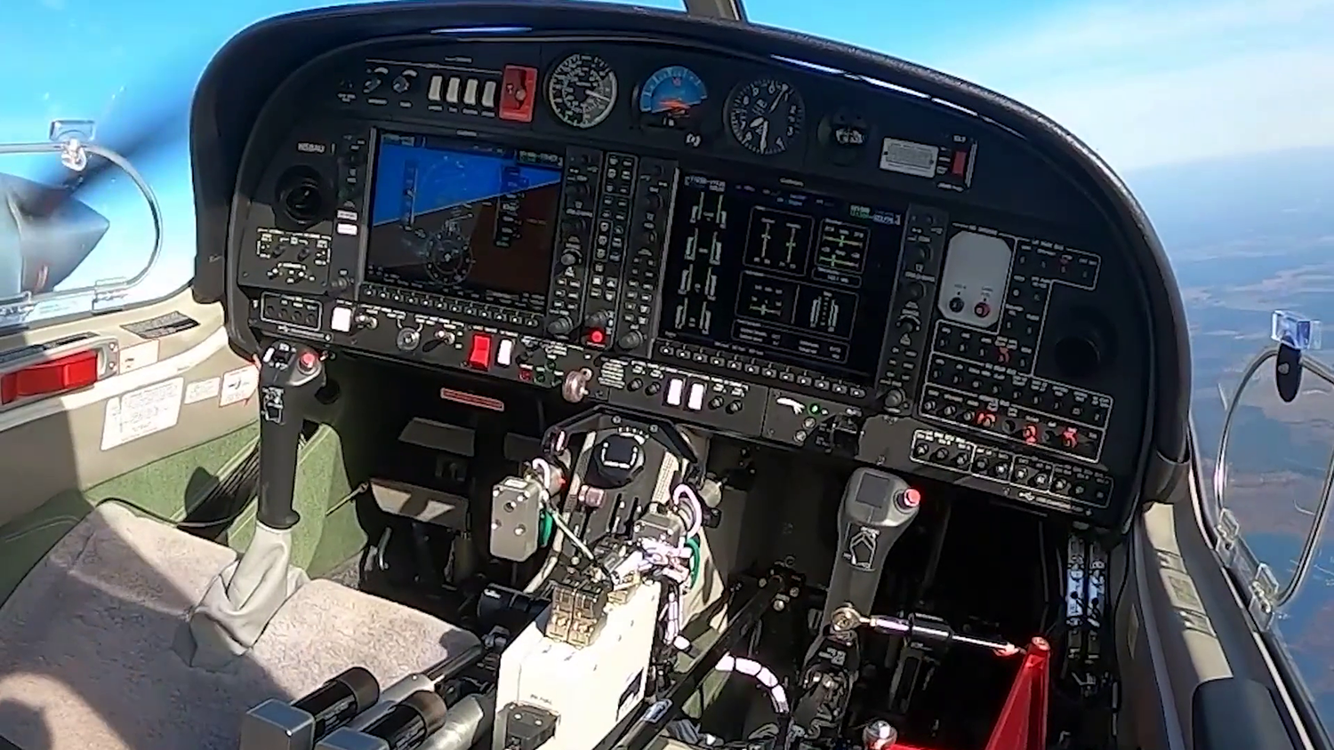
Alaska Airlines Capt. Bret Peyton looks at route options presented by Traffic Aware Strategic Aircrew Requests (TASAR) during a test of the software at Langley Research Center. The program connects to onboard systems and runs on a tablet called an electronic flight bag. Credit: David Wing
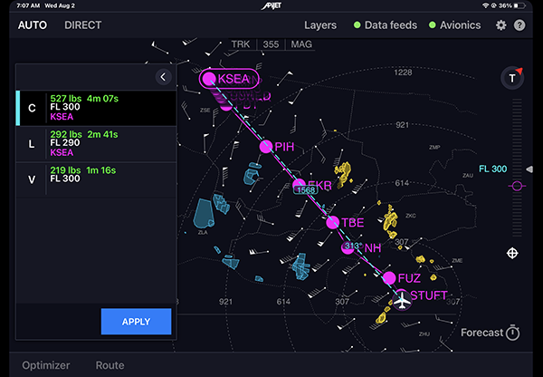
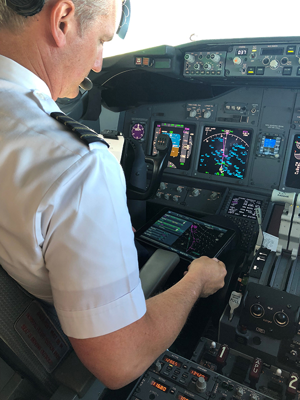
In this screenshot of the APiJET Digital Winglets software based on NASA technology, a route is plotted along navigational waypoints, presenting three options that would save fuel and time based on real-time information. Credit: APiJET LLC
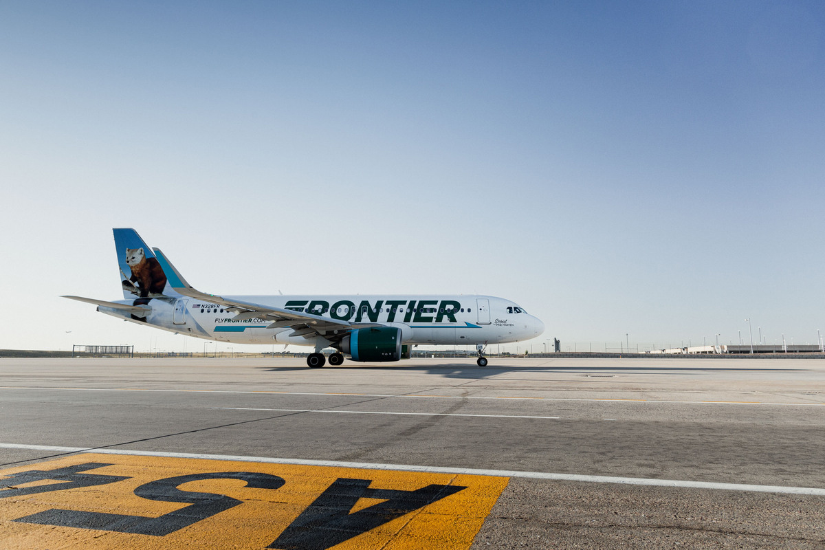
Frontier Airlines was among the first companies to test Digital Winglets for its fleet of aircraft. In testing, the commercial implementation of NASA’s TASAR technology provided fuel savings of 2%, which adds up at airline scale. Credit: Frontier Airlines