Drone Traffic Forecasts Show Commercial Skies of the Future
NASA Technology
It’s a safe bet that the skies of the future will be hosting a lot more drones than they do today. If you can see beyond the low-flying pizza and package delivery drones, higher-flying autonomous aircraft will be performing friendly tasks like monitoring air quality, mapping floods, gathering news, and maybe even carrying passengers on quick jaunts as air taxis.
Some of these activities have already begun, but they currently require special permission from regulators who haven’t yet determined all the technical and policy details of how to let everyone fly at once while maintaining safe airspace. The idea is to have large drones operate like other civilian aircraft according to existing rules in the air transportation system, but this will require additional technical specifications regarding what kinds of sensors and communications the drones should have.
“We expect a highly trained pilot to operate in a certain way because they understand the conventions of the air traffic system,” says Eric Mueller, who led a team at NASA’s Ames Research Center that worked with the Federal Aviation Administration (FAA) and others to reduce technical barriers to introducing drones into the national airspace. “We had to quantify that expected behavior and then turn it into requirements on the electronics.”
The team was specifically focused on how drones might detect and avoid objects in the airspace—called a see-and-avoid capability when referring to aircraft with onboard pilots who are watching the sky immediately in front of them. “We couldn’t simply build a system and fly it around and see if we ran into anybody and then say, ‘I guess the system isn’t good enough,’” Mueller says.
The team opted to understand the airspace through simulations. “We simulated tens of thousands of aircraft interactions,” Mueller says, “and we simulated the performance of the proposed detect-and-avoid system to see whether it met the safety requirements the FAA or community had established.”
The researchers had plenty of information about actual air traffic to feed into their simulations, but they also needed realistic information about drone trajectories and flight plans to set against the current air traffic data. It became something of a chicken-and-egg problem: to help the FAA write good drone regulations, NASA needed data on drone flights, but until the regulations were in place, that real-world data wouldn’t exist.
Technology Transfer
That’s how Mueller found himself working with Fred Wieland, director of research and development for air traffic management at Intelligent Automation Inc. (IAI), a technology development company in Rockville, Maryland.
In 2012, NASA funded future drone traffic research conducted by IAI, with help from Virginia Polytechnic Institute and State University, through an Ames-awarded Small Business Innovation Research (SBIR) contract. Mueller was NASA’s technical representative.
The difficulty was coming up with a credible forecast—something skeptics wouldn’t call a crystal ball. “When we began, we were perplexed,” Wieland admits. “Where would we get this data, and why would anyone possibly believe us?”
The IAI team started by looking at previously identified likely drone missions and then began contacting scores of subject matter experts—people in positions to know about the likely autonomous flights in their organizations or fields.
Wieland says his team expected civilian agencies and other organizations would simply shrug and say they didn’t know what they might do with drones. “Our first surprise was that was not the reaction we got,” he says.
In fact, every agency the company contacted already had people working out the logistics of future drone flights. In many cases, entire offices had already been set up to oversee drone operations. “They knew where they would be flying, when they would be flying, altitudes, flight paths,” Wieland says. “Our work, surprisingly, turned out to be fairly straightforward.”
Once the company demonstrated that credible forecasts were possible, it received SBIR Phase II money to continue building its database of likely flights, and then, eventually, more money specifically to commercialize the final product.
Wieland and his colleagues additionally looked at scholarly literature and socioeconomic data to determine 19 broad mission types, such as mapping and border patrol. They also included missions that don’t currently exist, like on-demand self-flying air taxi services. But they omitted likely delivery drones and amateur quadcopters that fly below 2,000 feet, because those aircraft are unlikely to encounter commercial aircraft outside the immediate airport vicinity.
The company identified 26,312 likely daily drone flights that would join the 27,000–28,000 commercial flights that currently fly each day—a striking addition to the airspace. Then IAI set about gathering as much information as possible on these drone flights—what airports would they use? What altitudes, trajectories, and flight paths would the unmanned aircraft systems (UAS) take?
“There already were projections of UAS activity out there,” Wieland says, “but they tend to be broad projections about manufacturing capability or the types of UAS aircraft that will be used in the future. To my knowledge there are no other projections that go flight-by-flight, as we did. No one else has this type of projection.”
Benefits
Back at NASA, Mueller and his team were able to plug the IAI data into their simulations.
“We didn’t say that any particular mixture of those flights was going to be the future scenario,” Mueller says. “What we did instead was look at a variety of possible scenarios with different combinations of missions. That way we could see where the safety metrics were sensitive to different selections of mission types.”
Mueller’s team went on to write detailed technical drone requirements in a several-hundred-page document it handed over to the FAA. “It’s basically an instruction manual for how the drone systems should be built by manufacturers,” Mueller says.
It was clear to both NASA and IAI that this enormous set of data on drone flight projections would have additional commercial applications—that’s why they chose the SBIR Program as the funding vehicle. IAI built an interface that allows users to easily filter the drone categories, altitude, duration, or virtually any aspect of the data, and the company currently sells the dataset on its website as a product called UAS-Max.
Instead of setting a date for the traffic projections, IAI says the dataset includes likely drone flights several years after regulations are finalized, so the project is ongoing in a sense. The company has already made some updates to the original set of flights.
IAI doesn’t discuss its customers or sales, but Wieland said broadly that drone researchers, regulators in charge of airspace safety, and military organizations are interested in datasets like UAS-Max. NASA remains the largest government consumer of the product, he says.
The project could have other benefits, as well, if the collection of tens of thousands of friendly missions can help counter drones’ image problem. “Most of the time when you hear about drones, it’s related to military operations overseas or invasions of privacy domestically,” says Mueller, who now works in a different NASA division on a project to enable a future urban air taxi transportation system. “This data could be useful to show the public potential benefits of unmanned aircraft operations.”
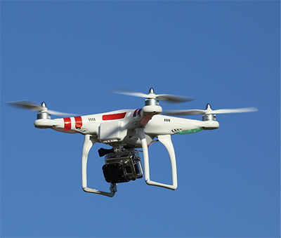
The skies of the future will likely host many drones doing tasks ranging from package and food delivery to monitoring air quality, gathering news, and perhaps carrying passengers. Software developed by IAI has helped regulators predict future drone traffic and develop the regulations that will allow them to function safely and smoothly. Image courtesy of Wikipedia user Don McCullough, CC BY 2.0

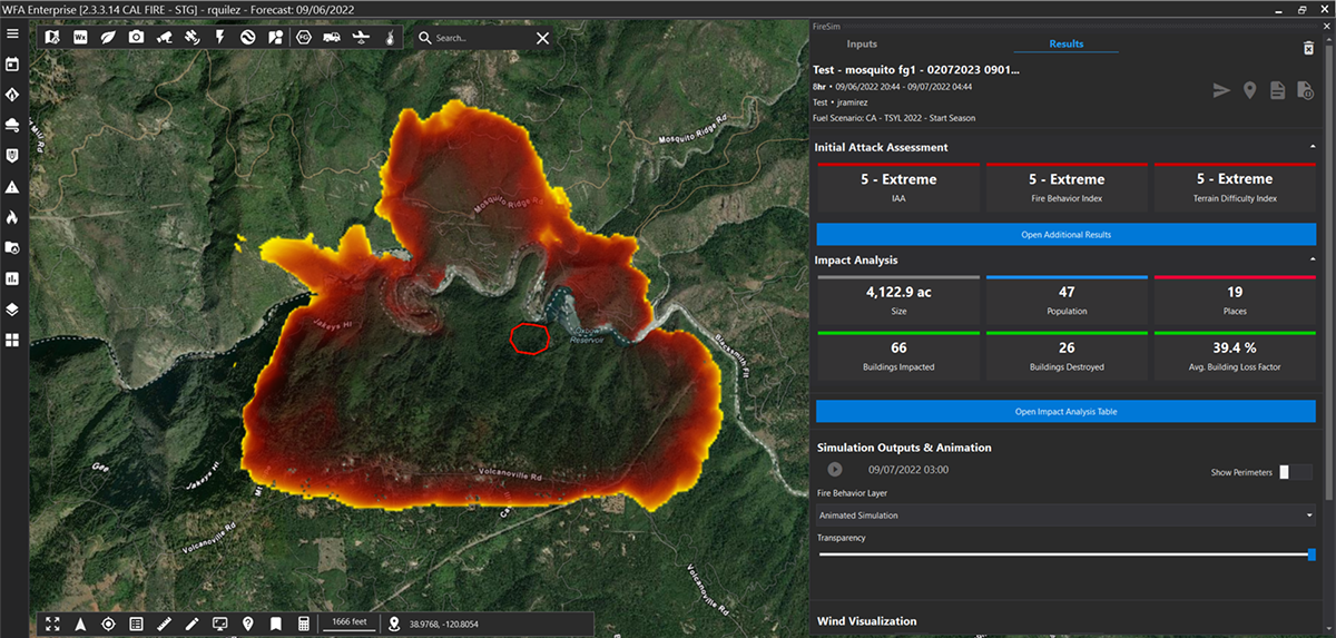
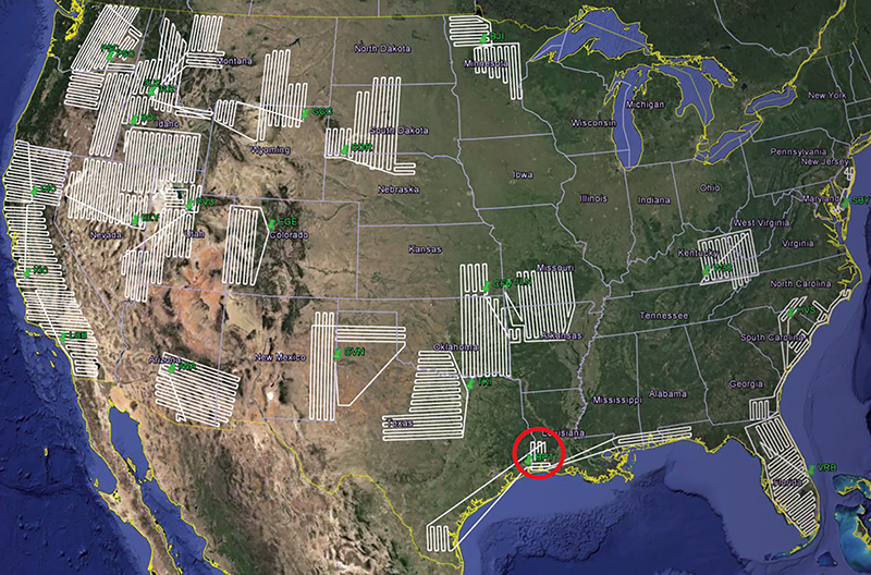
Shown here are flight plans for routes drones might fly to provide early detection of nascent wildfires. Intelligent Automation Inc. (IAI) used burn probability data to determine what types of flights would be useful and then mapped possible routes.


